Property Record
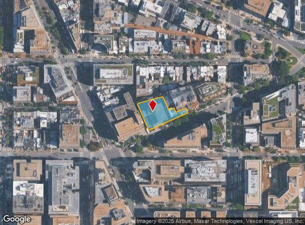
1725 Rhode Island Ave Nw, Washington, DC 20036


NEARBY LISTINGS FOR SALE OR LEASE
Property Detail
1725 Rhode Island Ave Nw
Washington-Arlington-Alexandria, DC-VA-MD-WV
Central
0159-0861
SQUARE 0159 LOT 0861 NBHD: CENTRAL
Religious
District of Columbia
X
District of Columbia
1100010016C
861
0
0.69 AC
2025
CBD
010700
Washington, DC
74,280 SF
DEMOGRAPHICS near 1725 Rhode Island Ave Nw
1 Mile
3 Mile
5 Mile
2024 Total Population
70,986
363,123
760,241
2029 Population
64,653
335,212
710,354
Pop Growth 2024-2029
(8.92%)
(7.69%)
(6.56%)
Average Age
36
37
38
2024 Total Households
39,925
189,074
359,734
HH Growth 2024-2029
(10.29%)
(8.39%)
(7.11%)
Median Household Inc
$114,132
$115,164
$108,033
Avg Household Size
1.60
1.80
2.00
2024 Avg HH Vehicles
1.00
1.00
1.00
Median Home Value
$763,344
$773,236
$758,980
Median Year Built
1963
1965
1963
Nearby Places
Map Layers
Map Styles
 Street
 Aerial
- Restaurants
- Banks
- Shops
- Fitness
- Groceries
PUBLIC TRANSPORTATION
COMMUTER RAIL
DRIVE
WALK
Distance
4 min
2.1 mi
DRIVE
WALK
Distance
4 min
2.2 mi
AIRPORT
Ronald Reagan Washington Ntl
DRIVE
WALK
Distance
Ronald Reagan Washington Ntl
12 min
5.7 mi
Washington Dulles International
DRIVE
WALK
Distance
Washington Dulles International
43 min
26.6 mi
Baltimore/Washington International Thurgood Marshall
DRIVE
WALK
Distance
Baltimore/Washington International Thurgood Marshall
48 min
31.9 mi
Freight Ports
Port of Baltimore
DRIVE
WALK
Distance
Port of Baltimore
56 min
38.2 mi
Nearby Properties
Address
Land Use
TOTAL SIZE
Lot Size
Zoning
Address
Land Use
TOTAL SIZE
Lot Size
Zoning
2,300,000 SF
1.60 AC
D-5-R
Address
Land Use
TOTAL SIZE
Lot Size
Zoning
2,052,109 SF
90.60 AC
UNZONED
Address
Land Use
TOTAL SIZE
Lot Size
Zoning
128,439 SF
373.22 AC
UNZONED
Address
Land Use
TOTAL SIZE
Lot Size
Zoning
533,778 SF
18.08 AC
UNZONED
Address
Land Use
TOTAL SIZE
Lot Size
Zoning
5,483 SF
88.76 AC
GOV
Address
Land Use
TOTAL SIZE
Lot Size
Zoning
1,517,010 SF
70.25 AC
UNZONED
Address
Land Use
TOTAL SIZE
Lot Size
Zoning
142 AC
GOV
Address
Land Use
TOTAL SIZE
Lot Size
Zoning
2,493,936 SF
8.99 AC
UNZONED
Address
Land Use
TOTAL SIZE
Lot Size
Zoning
3.71 AC
UNZONED
Address
Land Use
TOTAL SIZE
Lot Size
Zoning
63.89 AC
GOV
Address
Land Use
TOTAL SIZE
Lot Size
Zoning
1,583,364 SF
276.66 AC
UNZONED
Address
Land Use
TOTAL SIZE
Lot Size
Zoning
19.46 AC
CG-4
Address
Land Use
TOTAL SIZE
Lot Size
Zoning
3,750,395 SF
10.82 AC
UNZONED
Address
Land Use
TOTAL SIZE
Lot Size
Zoning
262,673 SF
5.35 AC
D-7
Address
Land Use
TOTAL SIZE
Lot Size
Zoning
1,530,865 SF
6.05 AC
D-6;UNZONE
Address
Land Use
TOTAL SIZE
Lot Size
Zoning
6,500,000 SF
92.03 AC
S-3A
Address
Land Use
TOTAL SIZE
Lot Size
Zoning
2,369,428 SF
7.93 AC
MU-10;SEFC
Address
Land Use
TOTAL SIZE
Lot Size
Zoning
42.57 AC
GOV
Address
Land Use
TOTAL SIZE
Lot Size
Zoning
2,455,000 SF
11.08 AC
MU-2
Address
Land Use
TOTAL SIZE
Lot Size
Zoning
52.44 AC
UNZONED
Address
Land Use
TOTAL SIZE
Lot Size
Zoning
1,100,000 SF
2.13 AC
D-6
Address
Land Use
TOTAL SIZE
Lot Size
Zoning
1,310,661 SF
3.38 AC
D-6
Address
Land Use
TOTAL SIZE
Lot Size
Zoning
1,043,058 SF
4.03 AC
UNZONED
Address
Land Use
TOTAL SIZE
Lot Size
Zoning
1,336,013 SF
5.41 AC
D-5
Address
Land Use
TOTAL SIZE
Lot Size
Zoning
1,738,573 SF
2.11 AC
D-7
Address
Land Use
TOTAL SIZE
Lot Size
Zoning
1,081,367 SF
6.46 AC
UNZONED
Address
Land Use
TOTAL SIZE
Lot Size
Zoning
185,826 SF
9.40 AC
UNZONED
Address
Land Use
TOTAL SIZE
Lot Size
Zoning
1.57 AC
D-5
Address
Land Use
TOTAL SIZE
Lot Size
Zoning
2,058,692 SF
4.77 AC
UNZONED
Address
Land Use
TOTAL SIZE
Lot Size
Zoning
1,015,833 SF
1.60 AC
D-7
The World's #1 Commercial Real Estate Marketplace
Connect with us
© 2025 CoStar Group
The information above has been obtained from sources believed reliable. While we do not doubt its accuracy we have not verified it and make no guarantee, warranty or representation about it. It is your responsibility to independently confirm its accuracy and completeness. Any projections, opinions, assumptions, or estimates used are for example only and do not represent the current or future performance of the property. The value of this transaction to you depends on tax and other factors which should be evaluated by your tax, financial, and legal advisors. You and your advisors should conduct a careful, independent investigation of the property to determine to your satisfaction the suitability of the property for your needs.